The preventive role the JRC plays before an earthquake or tsunami hit
Earthquakes are the natural hazard that generates the largest number of human casualties in the modern society. It is estimated that they are responsible for about 35% of the economic losses generated by disasters. They are also among the deadliest natural hazards, leading to large numbers of victims per event.
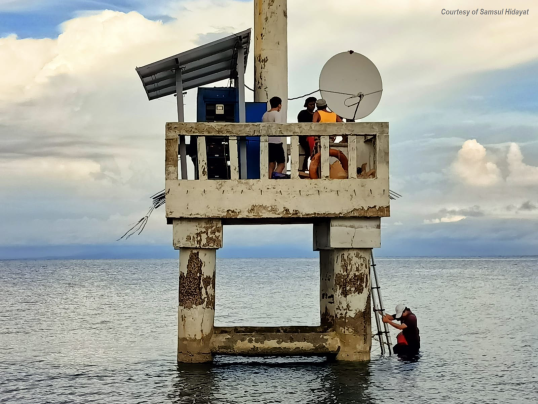
While the earthquakes that cause tsunamis cannot be predicted, it is possible to provide early warnings if there is enough distance between the seismic source and the coast. To mitigate the effects of earthquakes and tsunamis, JRC develops tools - such as the IDSL sea level measurement device - and methods to support efficient disaster management.
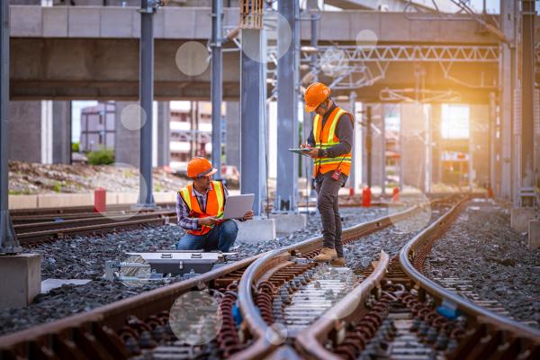
Also on the prevention side, JRC studies the structural behaviour of buildings and other infrastructures under earthquakes, develops methodologies to increase the safety of buildings and contributes to the creation of European standards for the construction sector. A recent report suggesting policy measures for seismic and energy upgrading of buildings for EU Member States has been recently published.
The development of such standards and policy suggestions is the result of multiple tests performed at JRC's European Laboratory for Structural Assessment. This lab is equipped with one of the largest reaction walls for testing the resistance of buildings against earthquakes.
Earthquake: is your house earthquake-proof? [video]
How does JRC contribute to earthquake and tsunami response when they hit?
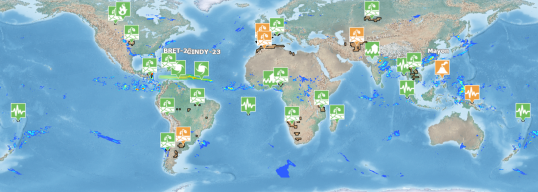
The Global Disaster Alert and Coordination System (GDACS) operated at JRC's European Crisis Management Laboratory alerts the first responders community, provides real-time access to web-based disaster information systems and related coordination tools. It helps to fill in the information and coordination gaps in the first phase after major disasters strike, helping emergency managers and humanitarian actors plan their next steps.
Tsunami: how to alert in time and save lives? [video]
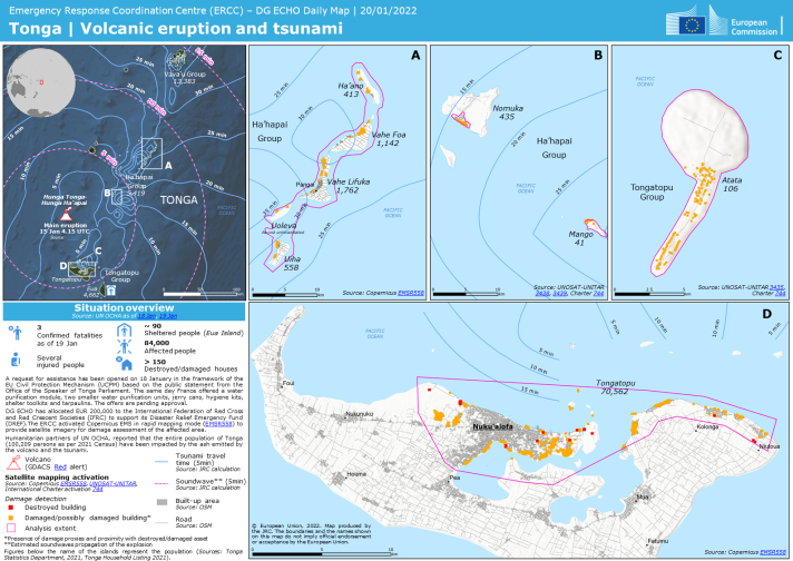
Satellite imagery can also help identify areas where interventions are most needed. The Copernicus Emergency Management Service (CEMS) operated at JRC also plays a fundamental role. By combining all the aforementioned information with data from local authorities and other key humanitarian actors such as the United Nations, JRC and the Directorate-General for European Civil Protection and Humanitarian Aid Operations (ECHO) work as true partners using science (under the shape of situational maps and reports) to support the EU emergency response within and outside Europe.
Check also: the science behind the EU’s response to the earthquakes in Türkiye and Syria.
International assistance, field missions and recovery assessments
JRC develops integrated systems for risk analysis, situational awareness, early warning and collaborative decision-making to help strengthen the EU’s resilience to crises and disasters. Different - often specialised - teams participate in field missions and other activities related to international assistance and mitigation of the effects of natural disasters.
Field missions are organised in concerted collaboration with international partners, universities and national services in the affected countries and other Departments of the European Commission. The aim is to collect information on the performance of buildings and infrastructure, socio-economic aspects and the management of the disaster. Attention is given also to rural and less developed regions as well as to cultural heritage. Field data is integrated with information obtained through remote sensing techniques that combine pre-earthquake satellite images and post-earthquake aerial photos. The collected material is used to improve the design methods for new structures and the techniques for strengthening and retrofit, to draft guidelines for the construction of safe non-engineered houses and to assist the management of the post-event and reconstruction phase.
Moreover, the on-demand mapping component of the Copernicus Emergency Management Service (CEMS) can help understand how an area is recovering from the impact of an earthquake, tsunami or another disaster. By comparing images from before, during and after (in different periods) it is possible to assess the recovery of a given region. CEMS' Global Human Settlement Layer also allows an automatic analysis of this recovery, distinguishing between residential buildings, industrial facilities, among others.
Tsunami assessment modelling system
As mentioned earlier, JRC has developed and operates the only worldwide automatic tsunami alerting system. It can quickly calculate the estimated wave height and travel time and automatically send an alert message through the Global Disaster Alerts and Coordination System (GDACS).
The JRC´s tsunami assessment modelling system includes four main components:
1) The Global Tsunami Scenario Database (GSD) is a set of 136 000 calculations performed using a theoretical model, with epicentres established around historical tsunami events. Calculations for earthquake magnitudes between 6.5 and 9.5 have been performed. The database provides a preliminary, immediate, estimate of tsunami consequences as soon as the real earthquake epicentre is known. The scenario database identifies the locations potentially affected as well as the predicted wave height.
2) The Tsunami Online Calculation System (OCS) uses the same model as the scenario database, but it is automatically initialised with the real earthquake parameters (epicentre and magnitude). The calculations start as soon as an earthquake with potential tsunami consequences is identified and the calculation time is in the order of 30–40 minutes.
3) The Tsunami Analysis Tool is a piece of software developed by the JRC to allow a proper analysis of Tsunami events in real time, during their occurrence, in order to give the possibility to quickly estimate the real potential consequences of a Tsunami; the objective is therefore to prepare to launch Warning Messages.. The software allows the direct comparison of scenario databases (GSD) or online calculations (OCS) with sea level measurements in real time though international channels.
4) The Tsunami Alerting Device (TAD) has been designed for installation in tsunami prone coastal areas. The TAD delivers warning messages to the population at risk in the quickest possible time. A prototype is currently operating in Setubal (Portugal). The TAD consists of a panel equipped with data receivers, a display, an alerting siren and a loudspeaker. It can be automatically activated by the GDACS system or can be connected with existing local sea level measurement systems. This allows the device to activate the alarm also in the case of dangerous waves of non-seismic origin such as those created by landslides.
Background information
Tsunamis are among the natural hazards that can result in the largest number of victims in single events. Only in recent years, tsunamis caused more than 250 000 casualties in the Indian Ocean in 2004 and more than 25 000 in Japan in March 2011.
While the earthquakes that cause them cannot be predicted, it is possible to provide early warning about tsunamis if the distance between the seismic source and the coast is not too short. After the Indian Ocean disaster in 2004, JRC has developed a system that uses sophisticated seismic and hydraulic modelling coupled with communication technologies to alert the humanitarian operators or Civil Protection bodies about tsunamis.
Nowadays, the “official” tsunami warning system - developed in the frame of UNESCO-IOC (Intergovernmental Oceanographic Commission) - relies only on seismic signals and provide information on the arrival times of the tsunami wave along coastal areas. Other national systems are more advanced. For example, the Japanese national tsunami warning system relies on pre-calculated tsunami scenarios, allowing it to issue a first alert within 3 minutes of an earthquake that scores more than 6.5 on the Richter scale.

