After the devastating floods in Slovenia, Norway and Sweden during August, September brought more floods and destruction across various regions. The Mediterranean storm Daniel caused flooding in Libya and Greece and another low-pressure system over the Iberian Peninsula caused further floods in Spain. CEMS provided flood forecast information raising the awareness about the upcoming floods and delivered flood extent and impact maps to support response measures.
Flood damage assessment maps
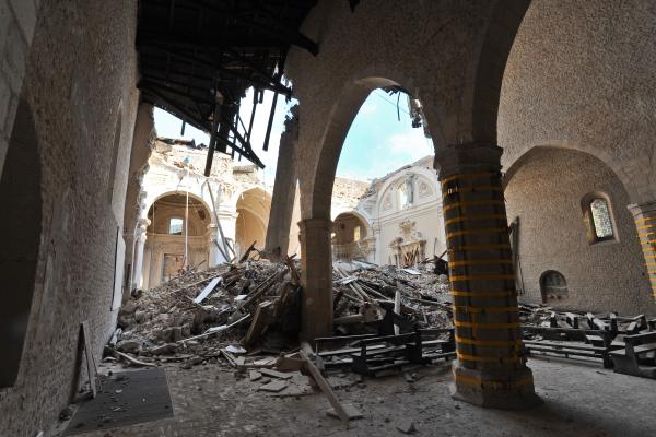
Mediterranean Storm Daniel swept through Libya on September 10th, causing thousands deaths, many more displaced and significant natural and economic damage. CEMS’ rapid mapping team quickly produced flood damage assessment maps.
These maps promptly pinpointed submerged areas and assessed the extent of destruction, providing the European Commission’s Directorate-General for European Civil Protection and Humanitarian Aid Operations as well as national authorities and international aid organisations – with valuable information to support much-needed response and recovery efforts.
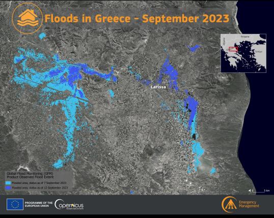
On September 5th, Greece's Thessaly Region faced widespread flooding due to relentless rainfall. In response to Greek authorities' request, CEMS provided 25 maps detailing flooded areas and other impact details like the number of people affected or buildings damaged. Less than a month later, similar analyses were done for another flood event in the same Greek region.
Hydrologists, remote sensing experts and humanitarian project officers from the Commission provided similar assistance for the floods in Spain on September 3rd.
Satellite mapping and flood early warning systems for disaster preparedness and response
Creating maps from satellite data relies on satellite availability. As such, anticipating when a satellite will be flying over an area of interest is key to make sure it captures the images needed to assess the situation.
The rapid mapping team often uses CEMS’ Global Flood Monitoring (GFM) tool to identify possibly affected areas and determine which satellites can capture the images needed. After satellite imagery (at a spatial resolution of 20m) is collected, the GFM tool can create flood monitoring maps within less than eight hours.
Besides CEMS’ rapid mapping important role supporting aid and relief efforts during September’s floods, an anticipatory approach was also taken. CEMS’ early-warning systems on floods – the European Flood Awareness Systems (EFAS) - provided timely forecast information to raise the awareness about the increased likelihood of floods for the coming days.
These forecasts alerted about the high likelihood and location of the upcoming floods, encouraging the deployment of preparedness strategies. While being complementary to national forecast systems, these forecasts are particularly critical in regions where national or regional flood early warning information might be limited or absent.
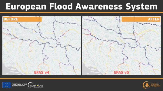
Updates to the Global and European Flood Awareness Systems
The European Flood Awareness System (EFAS) and the Global Flood Awareness System (GloFAS) are vital components of CEMS. Last month’s upgrades to EFAS 5.0 and GloFAS 4.0 have been tailored to better meet the needs of practitioners and others using flood/hydrological data for policy and research purposes.
EFAS 5.0 now has a higher spatial resolution at 1.4km, employs a different projection system, and covers a larger modelling area. It incorporates the latest research findings, remote sensing techniques, and in-situ data, enhancing its predictive accuracy.
GloFAS 4.0 has twice the precision it had - which translates in a 0.05 degrees (approximately 5km) resolution – and integrates the most up-to-date research and datasets. The open-source hydrological model LISFLOOD, central to GloFAS, has undergone significant improvements, enhancing its simulation and prediction capabilities.
As we enter the wetter months of autumn and winter, the risk of floods increases. With these advancements in CEMS's early warning systems, the Commission remains committed to providing timely support for managing floods and other natural and man-made hazards.
Related links
Copernicus Emergency Management Service
Details
- Publication date
- 6 October 2023
- Author
- Joint Research Centre
- JRC portfolios