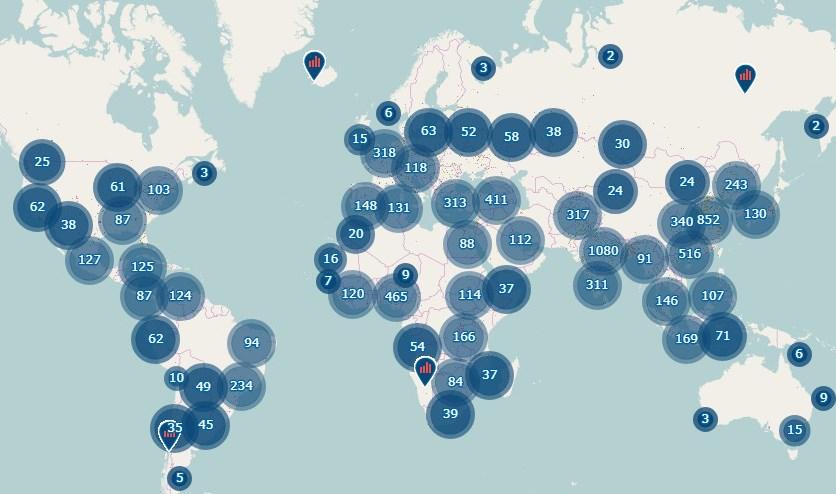
The JRC's new Urban Centres Database provides new open data for over 10 000 cities worldwide.
Data analysis highlights very diverse development patterns and inequalities across cities and world regions.
Building on the Global Human Settlement Layer (GHSL), the new database provides more detailed information on the cities' location and size as well as characteristics such as greenness, night time light emission, population size, the built-up areas exposed to natural hazards, and travel time to the capital city.
For several of these attributes, the database contains information recorded over time, dating as far back as 1975.
Responding to a lack of consistent data, or data only limited to large cities, the Urban Centre Database now makes it possible to map, classify and count all human settlements in the world in a standardised way.
An analysis of the data reveals very different development patterns in the different parts of the world.
"The data shows that in the low-income countries, high population growth has resulted only into moderate increases in the built-up areas, while in the high-income countries, moderate population growth has resulted into very big increases in the built-up areas. In practice, cities have grown more in size in richer countries, with respect to poorer countries where the populations are growing faster", said JRC researcher Thomas Kemper.
According to JRC scientists, around 75% of the global population now live in cities, towns or suburbs.
Many of these areas, together with the houses and people living in them, are exposed to natural hazards.
"In Asia and Africa, high population growth has led to more people being exposed to natural hazards. In Asia, the number of urban centres exposed to storms is higher than the total number of urban centres in all the other continents combined", Thomas said.
Most city centres expand on land which could otherwise well be used for agriculture, which also poses challenges in terms of preserving soil resources.
With just one click, the new database also enables to see which cities in the world are becoming greener, where air pollution (PM2.5 concentrations) is above healthy levels, and which cities have increased night time lights between 1995 and 2015.
"In Asia, Africa and Oceania, over half of the urban populations live in scarce night-time lighting, which limits access to services and activities, but also lowers the standards of housing and living", Thomas explains.
The database shows that in overall terms, the world's cities are becoming greener but low-income countries and high-income countries are coping very differently with air pollution.
Indeed, while particle emissions (PM2.5) have decreased in high income countries, they have substantially increased in developing countries.
The City Centres Database provides new open data supporting the monitoring of UN Sustainable Development Goals, the UN's New Urban Agenda and the Sendai Framework for Disaster Risk Reduction.
The main findings based on the Urban Centre Database are summarised in a new edition of the Atlas of the Human Planet, published together with the database.
Details
- Publication date
- 28 January 2019
