Floods are among the most devastating natural hazards. They are a threat to human lives, often displacing communities and inflicting billions in economic damages worldwide. In this context, scientists working at the Joint Research Centre (JRC) provide critical data on flood patterns, enabling policymakers and relevant authorities to devise informed strategies.
The primary responsibility for preventing, preparing for, and responding to natural and man-made disasters lies within countries. But through cutting-edge algorithms combining in-situ data (e.g. river heights) with meteorological forecasts, JRC sends alerts to registered authorised users about potentially-affected regions or river/tributary sections.This allows them to devise response strategies to protect people and livelihoods.
At JRC, we are proud to contribute to the global understanding of flood dynamics by sharing all our data freely with the international community. This allows fostering collaborations and exchanging best practices within dedicated expert groups. The social media for disaster risk management expert group is a key example of such collaborations. Together, we work to help nations worldwide prepare for the challenges posed by coastal and river flooding.
How does JRC contribute to minimising flood impacts?
JRC's work on floods takes place during the preparedness and response phases of this disaster.
At the latter state - when a flood already occurred - we help with flood response by monitoring the flood extent and doing damage assessments via the rapid mapping component of the Copernicus Emergency Management Service (CEMS). Recent examples include our work on the floods in Greece, Norway or Italy.
At the preparedness phase - before a flood hits - we develop the following activities:
- early warning and monitoring activities (see the platforms below);
- anticipatory scientific research on flood mitigation and prevention measures (see PESETA IV studies below).
For all these activities, our hydrologists and GIS experts rely on the use high-resolution climate information, hydro-morphological datasets, hydrological modelling and statistical analyses.
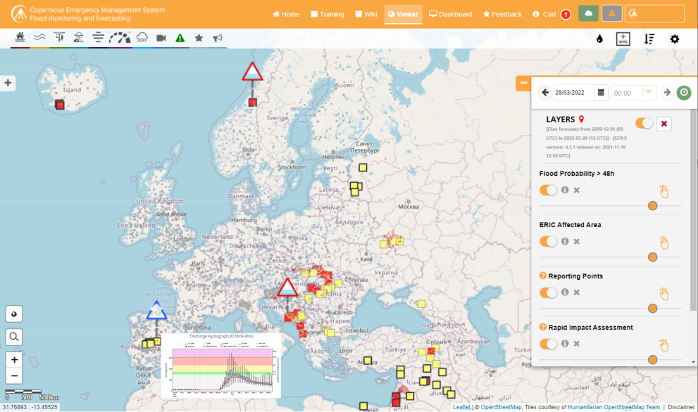
The European Flood Awareness System (EFAS) is the first operational pan-European flood forecasting and monitoring system.
EFAS provides constantly updated early flood forecasting information to support national and regional flood risk management authorities in arranging preparatory measures before an event strikes. It also estimates and maps the potential socio-economic impact of those events.

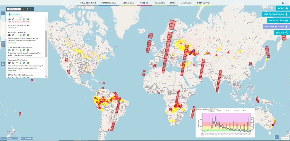
The Global Flood Awareness System (GloFAS) is the global extension of the European Flood Awareness System. It provides information and forecast floods across the world.
GloFAS provides probabilistic hydrological predictions and overviews across the world on time scales from days to few months, independent of administrative and political boundaries. It is therefore especially beneficial for the flood risk management of large trans-national river basins, as well as for international and national water management or aid-related organisations.

How will climate change increase floods risk?
River floods
With 3°C global warming, river flood damage in the EU and UK in 2100 would be six times larger than current losses, reaching €48 billion/year, and nearly 0.5 million people would be exposed to flooding annually (compared to 170,000 now). The economic impacts could be halved, and the number of people exposed reduced by 230,000, if global warming is limited to 1.5C.
Adaptation strategies could further reduce future flood impacts significantly, in a cost-effective manner, and have co-benefits. For example, reducing river flood peaks by installing retention reservoirs would reduce river flood damage in 2100 by nearly 40 €billion/year and also improve ecosystem quality.
Read more about climate change and river floods
Coastal floods
Without mitigation and adaptation measures, annual damage from coastal flooding in the EU and UK could increase sharply from 1.4 €billion nowadays to almost 240 €billion by 2100.
Around 95% of these impacts could be avoided through moderate mitigation and by raising dykes where human settlements and economically important areas exist along the coastline. The extent to which adaptation can lessen the effects of coastal flooding and at what cost is sensitive to the investment strategy adopted.

