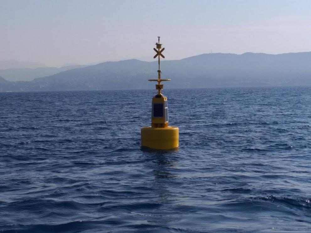
Today a new oceanographic buoy has been positioned off shore close to La Spezia harbour to monitor the sea level and identify Tsunami events.
Experiment
The buoy has been positioned off shore the Tino Island, in the Tirrenian Sea. The buoy is part of a scientific research, carried out in a collaboration between the JRC and the 'Istituto Superiore per la Protezione e la Ricerca Ambientale' for the sea level monitoring and the identification of Tsunami events. After a testing period of 8-9 months in the Tirrenian sea, if the results and the data acquired are satisfactory, the buoy will be repositioned in southern areas where the Tsunami risk may be larger, the Ionian Sea or Sicily Channel.
Method
The buoy has been instrumented by JRC with advanced instrumentation that allows the centimetric estimation of the sea level, using the differential GPS technique; the method consists in measuring the relative height between the buoy and a fixed point on the coast (base), using GPS antennas. The level data are then transmitted every 5 seconds to the server and are available for the monitoring of possible relevant events. A software onboard allows also the identification of anomalous wave signals and inform the users. In Italy the institution monitoring the tsunami events is the 'Istituto Nazionale di Geofisica e Vulcanologia' (INGV) but also other European institutes are interested in the off-shore measured levels.
Modern technology at low cost
In general the sea level is measured inside ports, on the coast. For instance JRC developed and installed a large network of Tsunami on-shore devices (Inexpensive devices for Sea Level measurements, IDSL), distributed in the Mediterranean Sea and recently adopted also by Indonesia. In the case of the buoy the advantage is to position it at 10-15 km from the coast, allowing to have an alert signal before the waves reach the coast. This technology is not new as it is in use in Japan since several years, but it is the first time that is adopted in the Mediterranean Sea. In addition, using modern technologies at low cost, JRC was able to considerably reduce the costs respect to the Japanese models.
All data are available here.

Related Content
Details
- Publication date
- 2 July 2019
