The recent Special Issue of Landscape Ecology (Volume 34, issue 9), edited by US and JRC scientists, examines the current status and future directions of landscape pattern analysis.
The 14 contributions of the Special Issue feature perspectives about the measurement of landscape patterns, research articles on emerging pattern metrics and their applications, and a review of new developments in pattern measurement for landscape ecology that will provide essential information for a wide range of disciplines.
Landscape pattern metrics
Landscape pattern metrics and analysis are part of the relatively new science of landscape ecology, which examines and identifies trends in land cover change, and the interactions between landscape patterns and ecological processes (i.e. how the structure of a landscape affects the abundance and functioning of organisms and the landscape as a whole).
Changes in the structure of landscapes can indicate important changes in ecological functions, such as forest connectivity and species movements, number and size of farm patches, effects on water quality and fire regimes, and soil carbon sequestration.
A wide array of landscape pattern metrics have been developed over recent decades using advanced technologies such as remote sensing, GIS and computation models. They are used to inform a broad range of disciplines and research in areas including environmental sciences, ecology, geography, geosciences, remote sensing, land use/urban planning, biodiversity conservation, forest and water resources, and computer science.
Looking to the future
Developments in the availability of ‘big data’ derived from remote sensing, on-site measurements, crowdsourcing and historical archives point to a future in which enormous amounts of information can be leveraged to better understand spatial patterns and inform decision-making.
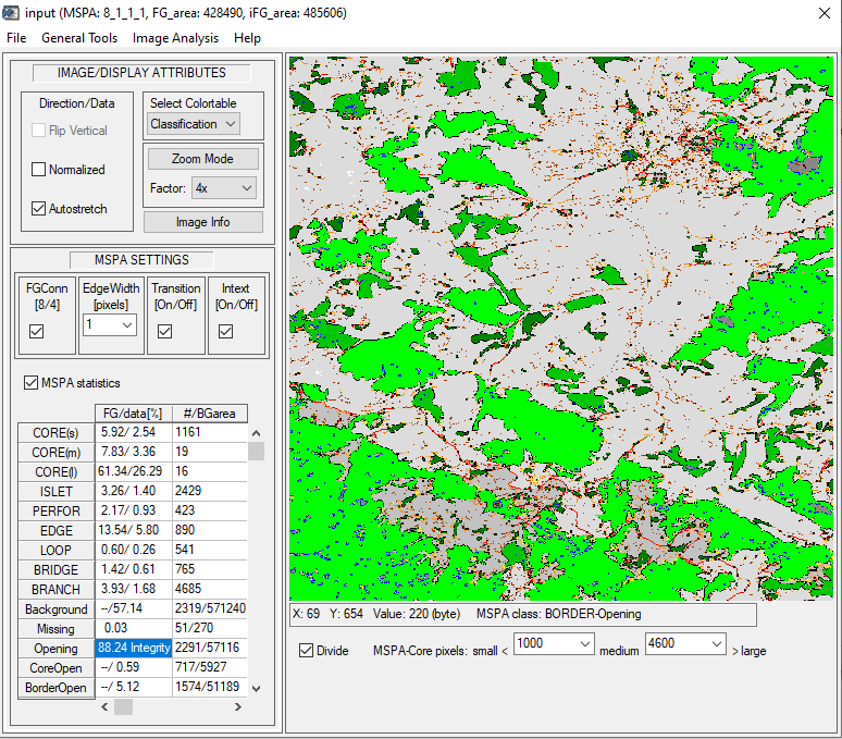
Future applications of landscape pattern metrics will depend on the software and analysis tools available, such as for example the JRC’s GuidosToolbox (developed by JRC scientist Peter Vogt, one of the editors of the Special Issue), which facilitates the use of pattern analysis metrics to adequately quantify and consequently interpret status and trends in landscape patterns, and digital images in general.

As Peter points out in his contribution to the Special Issue, landscape ecology software must be user-friendly, and allow users to visualise and quantify pattern metrics to better understand the results of pattern analysis.
The authors highlight that landscape pattern metrics should also be reproducible and replicable, using freely available software and a set of well-defined metrics that can be used in a wide range of studies.
By developing general and specific landscape pattern metrics, landscape ecologists can help integrate landscape pattern measurement across many ecological and related disciplines, to better inform decision-making and policy development.
Further information
- Describing and analyzing landscape patterns – where are we now, and where are we going?
- GuidosToolbox
Related Content
Describing and analyzing landscape patterns – where are we now, and where are we going?
Details
- Publication date
- 30 September 2019
