The Joint Research Centre (JRC) has released the software of its SUMO maritime surveillance tool, which is helping to protect our oceans by detecting ships engaged in illicit activities.
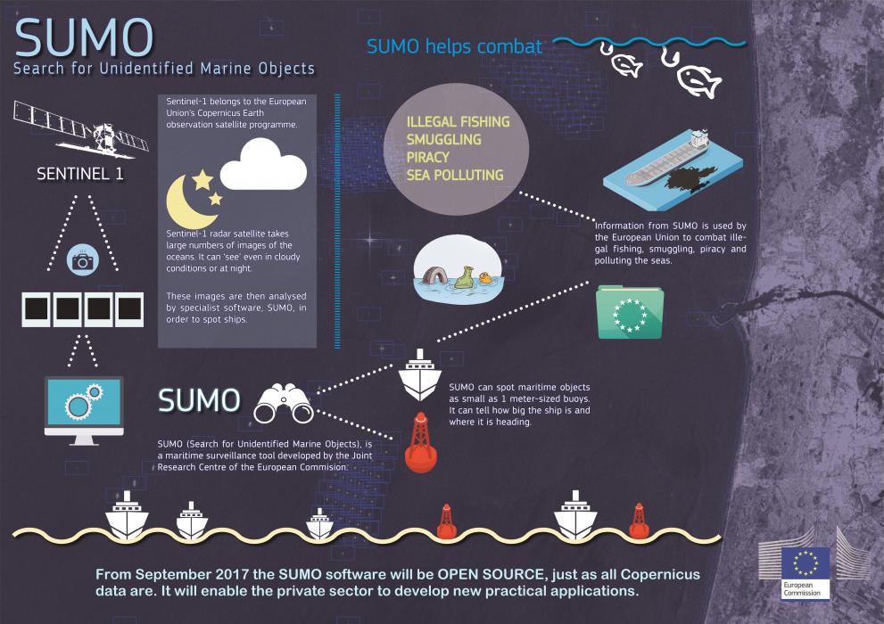
SUMO (Search for Unidentified Marine Objects) automatically scans large numbers of satellite images for the presence of ships. The results can be cross-checked with other maritime data to identify suspicious vessels.
The software has been developed, tested and validated by the JRC. It has been used to help fight illegal oil dumping, piracy and unsustainable fishing, contributing to increased maritime security.
Making the software open source allows other developers to add additional functionalities to it and improve it further for the benefit of everyone.
SUMO takes advantage of the growing use of radar satellites, which are the most suitable for detecting ships because they can ‘see’ them even in cloudy conditions or at night.
Large numbers of images of the oceans are now generated by Earth-orbiting radar satellites, but scanning them for ships is a complex process and would not be manageable without the help of software such as SUMO.

Supporting Copernicus
The availability of satellite images has hugely increased by the open data policy of the European Union’s Copernicus Earth observation satellite programme, which includes the radar imaging satellite Sentinel-1.
The data collected by Sentinel-1 and the rest of the Copernicus programme is available for free to all users. The programme will enable the private sector to convert basic Copernicus outputs into information services tailored to specific users, enabling better monitoring of the Earth and at the same time stimulating economic activity.
Making the SUMO ship-detection software available as open source enhances the toolset that will enable further practical applications of the Copernicus programme.
What SUMO does
Designed to be used in fully automatic mode or in conjunction with human operators, SUMO can spot – depending on the accuracy of the satellite used – maritime objects as small as a 1 metre-sized buoy and can identify a vessel’s size and where it is heading.
The software is used to support the EU's Vessel Detection System (VDS) to combat illegal fishing, which threatens to deplete fish stocks.
The VDS system takes data from EU fishing vessels, which are legally required to transmit their position to fisheries authorities at regular intervals, and compares it to the data it has obtained from analysing satellite images with SUMO. Within minutes, it can tell if activity on the ocean does not match with positions reported, and fisheries inspection authorities can be alerted to investigate.
The ship-detection tool has many other applications, including mapping ship routes, monitoring shipping intensity as an indicator of economic activity, helping to identify polluting ships, countering piracy and smuggling, and maritime border control.
The SUMO software is publicly available online.
Related Content
Details
- Publication date
- 27 September 2017
