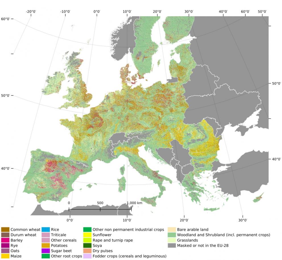
The JRC has published the first continental map of crops grown in the European Union at 10-m resolution.
This map combines Copernicus Sentinel-1 satellite observations and in-situ LUCAS 2018 Copernicus data using machine learning and cloud computing.
An EU-wide crop-type map
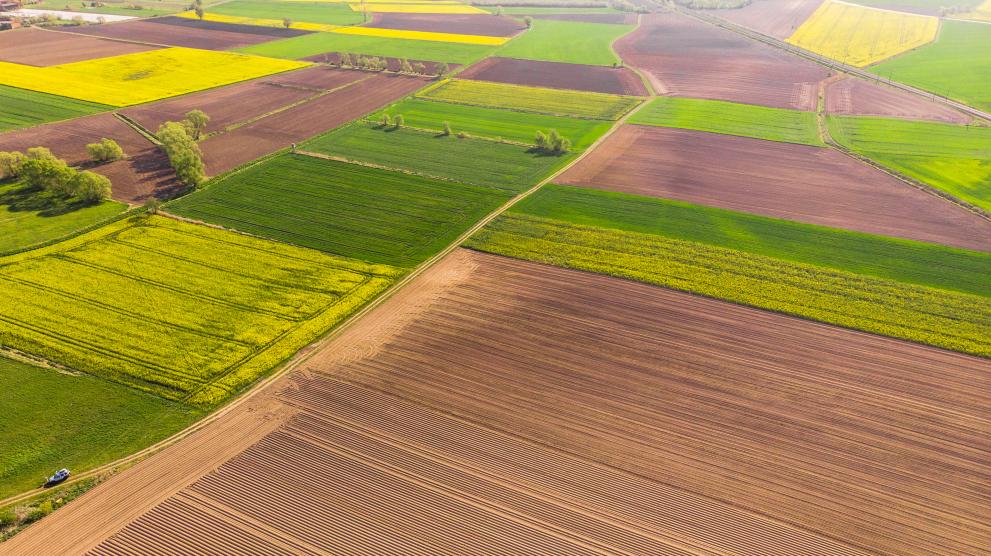
For the first time we have a map that allows us to zoom down to cultivated parcels for the entire European Union (EU) territory. On these parcels, we can see what crops were grown in 2018.
The EU crop map covers 91 million hectares of cropland and consists of more than 9 billion 10-m pixels!
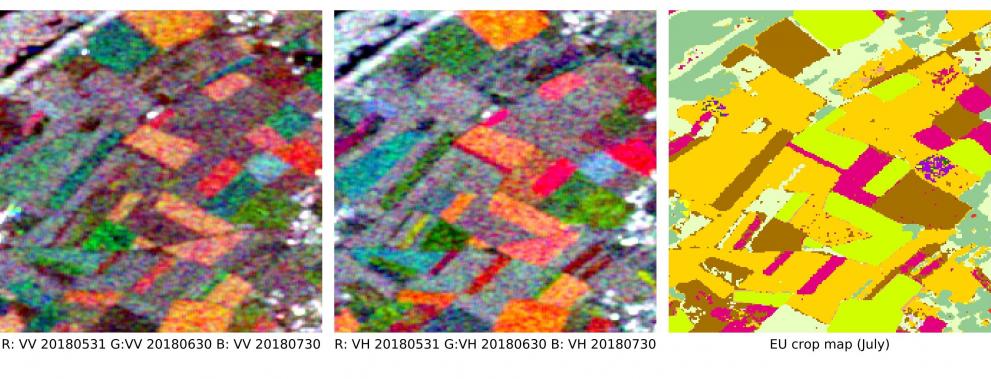
The map is based on Eurostat LUCAS in-situ data and Sentinel-1 (S1) Synthetic Aperture Radar (SAR) observations.
JRC scientists used machine learning and cloud computing infrastructures to bring these datasets together and develop accurate mapping algorithms.
Algorithms trained on time series of S1 data from the main growing season (January to end of July) capture the crop growing during that period on any agricultural area.
As a result, every field in the EU cropped with wheat, maize, rapeseed, barley, potatoes, sugar beets, and other types of crops (19 types in total) is mapped for the first time at a very fine spatial scale.
Published in Remote Sensing of the Environment, this research opens new avenues for agriculture, environment, climate, and biodiversity monitoring from the parcel all the way up to the European continent.

Copernicus Sentinel-1
The Copernicus S1 is a two-satellite (Sentinel-1A and Sentinel-1B) constellation carrying a C-SAR sensor which operates with its own source of microwave radiation.
Since radar ‘looks’ through the clouds it operates in all weather conditions, and all of the S1 sensor’s data acquisitions can be used for crop-type mapping.
Although dependent on year-to-year phenological development, findings from the JRC study regarding the best timing for mapping specific crop types are likely to be valid for future studies and can underpin future operational services.

LUCAS Copernicus module
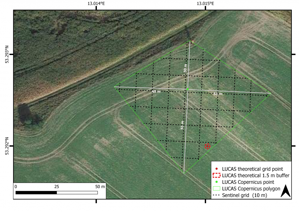
The Land Use/Cover Area frame Survey (LUCAS) is an evenly spaced in-situ land cover and land use ground survey exercise that extends over the whole of the EU. LUCAS was carried out in 2006, 2009, 2012, 2015, and 2018.
A new LUCAS module specifically tailored to Earth observation (EO) was introduced in 2018: the LUCAS Copernicus module. This module surveys the land cover extent up to 51 m in four cardinal directions around a point of observation, offering in-situ data compatible with the spatial resolution of high-resolution sensors such as Sentinel-1 and Sentinel-2.
Since it provides such useful information for EO applications, the Copernicus module will be repeated in 2022 for 150,000 samples in the EU.

Policy implications
The Copernicus fleet of Sentinel satellites are transforming how policy impacts can be monitored from space.
By providing synergistic and 10-m scale near-daily revisit data over Europe, the Sentinel-1 (used in this study) and the Sentinel-2 constellation (which carries optical sensors) have pushed land monitoring into the big data era.
Arable land represents almost half of the EU’s land surface area, and the common agricultural policy (CAP) accounts for 38% of the EU budget.
Monitoring arable land across scales is therefore crucial for implementing and evaluating EU-wide environment, agriculture, and climate policies.
This new map, which has an accuracy rate of about 80% (as verified by comparing with LUCAS data and farmers’ crop declarations) is freely available for anyone to access and use it.
Future perspectives
The EU crop map is a product of the current momentum towards combining Copernicus Sentinel fleet observations, extensive in-situ data and cloud computing.
More scientific and methodological development is needed to transform this first demonstration into an operational in-season mapping service and to translate spatial information into sound environmental indicators.
Such perspectives also rely on the availability of high-quality (in-situ and satellite-based) European data (such as those provided by Copernicus) and ad-hoc European cloud computing infrastructure.
Further information
- From parcel to continental scale – A first European crop type map based on Sentinel-1 and LUCAS Copernicus in-situ observations
- LUCAS Copernicus 2018 : Earth-observation-relevant in situ data on land cover and use throughout the European Union
- Accuracy Assessment of the First EU-Wide Crop Type Map with Lucas Data
- Copernicus – Europe’s eyes on Earth
- LUCAS – Land use and land cover survey
Related Content
Accuracy Assessment of the First EU-Wide Crop Type Map with Lucas Data
Details
- Publication date
- 18 October 2021
