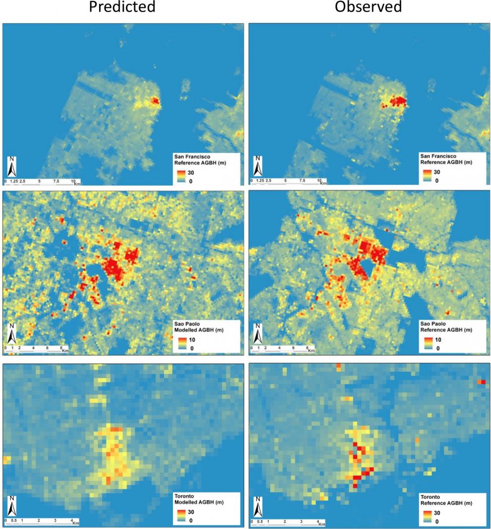
The global building stock is still largely unknown. While the location of built-up structures is mapped at unprecedented scale by the Global Human Settlement Layer, the height and volume of buildings has not been mapped systematically, leaving gaps in our understanding of the cities and their role in climate change and disaster risk.
In a new study published in PLOS ONE, JRC scientists developed a statistical model to estimate the vertical dimension of built-up areas using open and free global Digital Elevation Models (DEM) and features derived from Earth Observation data.
Knowledge of the building heights is necessary to calculate their volume. The building volume, and the amount of concrete necessary to build them, influences future carbon emissions under scenarios of continuous urbanization and climate change. The vertical dimension of built-up areas plays a major role in urban heat islands by affecting the urban energy balance, and is key in Earth System Modelling. It is also a key predictor for rubble generated by disasters such as earthquakes.
The JRC scientists used five global Digital Elevation Models derived from satellite sensors that are available in the frame of the Global Earth Observation System of Systems (GEOSS). They tested them for their capacity to predict the morphology of built-up areas. The model was calibrated and tested within six different cities: Hong Kong, London, New York, San Francisco, Sao Paulo, and Toronto. The selection of the sites aimed at maximizing, given the limited available reference data, the heterogeneity of urban morphologies. In this approach, an overall Root Mean Square Error 2.40 meters was obtained for the Average Gross Building Height.
These results show that global DEM sources may be used to derive statistically generalized parameters describing the vertical characteristics of built-up areas, at the 250 m spatial resolution. The proposed model is based on well-established statistical methods and able to generalize the findings to the global context.
Pesaresi M, Corbane C, Ren C, Edward N (2021) Generalized Vertical Components of built-up areas from global Digital Elevation Models by multi-scale linear regression modelling. PLoS ONE 16(2): e0244478. https://doi.org/10.1371/journal.pone.0244478
Details
- Publication date
- 10 February 2021
